
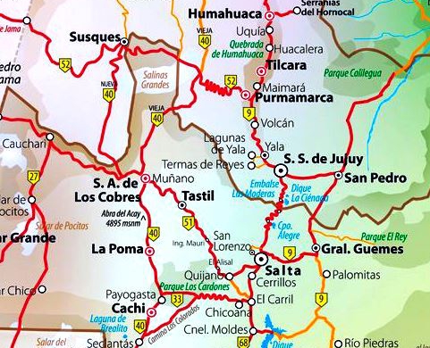
The most classic and popular of the cartography formats on a global, regional or local level. Political, environmental, thematic, bilingual, historical maps, etc.
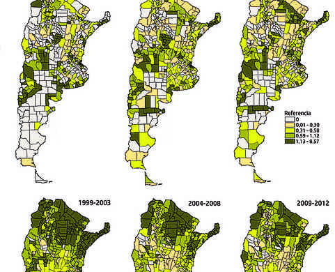
Search and representation of geographic data: population, economy, environment, etc. Processing, digitization, georeferencing. Own or public data.
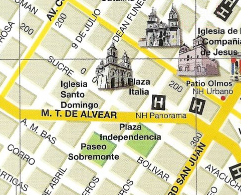
Maps of cities and their streets with useful references for tourist, commercial or public information. Street, tourist, commercial plans.
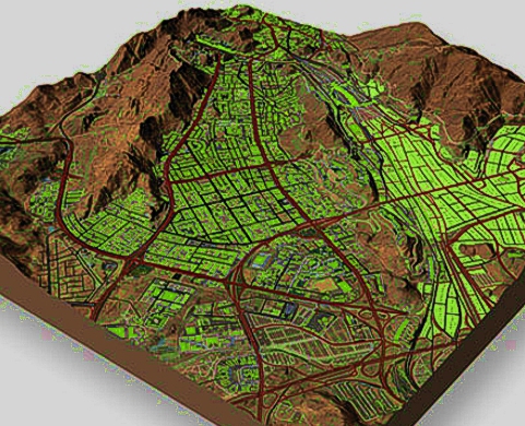
The possibility of representing the relief in three-dimensional diagrams. Topography, contour lines, globe view.
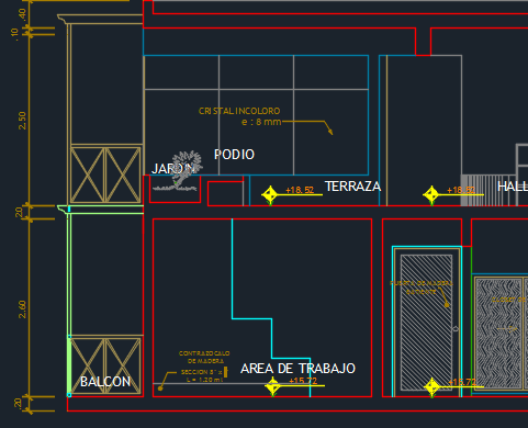
All kinds of drawings in CAD format: plans, installations, diagrams, etc.
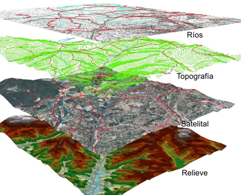
All the advantages of Geographic Information Systems available.


Geographer with extensive experience in Cartography and GIS. Graduated from the Universidad Nacional del Sur (Bahía Blanca, Argentina).
Jobs in different companies and public agencies in GIS as well as Territorial Planning and Environmental Impact Assessment.
Long experience in software applied to cartography: ArcGis; QGis, Surfer as well as AutoCad and the CorelDraw graphic design package, among others.
For all kinds of questions, budget requests or info you can call me by phone or whatsapp, send me an e-mail or complete the attached form and I will contact you.
© 2020 Carto Digital
Al navegar por la página aceptas la Política de Privacidad, Cookies y Terminos y Condiciones de Uso